Intertidal Coastal Sediment Transport Research Unit (In_CoaST)
Examining interactions and feedbacks.
The In_CoaST Research Unit was created in 2008 with funding from CFI and NSRIT.
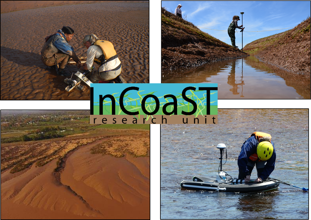
This lab examines the interactions and feedbacks that occur between topography, biota, hydrodynamic and sedimentary processes and the resultant adjustment of intertidal morphology. Of particular interest is the response of intertidal environments to changes in forcing functions (e.g. wind, waves, currents, sediment, vegetation, topography, tides and sea levels) and how anthropogenic activities (e.g. causeway construction, dyking) impact this response. These relationships are examined across a range of temporal and spatial scales, in collaboration with MP_SpARC (Maritime Provinces Spatial Analysis Research Centre,) established in 2001.

The In_CoaST Research Unit consists of traditional lab facilities in S404 in the science building at Saint Mary’s University for detailed analysis of sediments, including a Coulter Multisizer 3.
This lab is equipped with field instruments for high precision measurement of hydrodynamics (Nortek ADV and ADCP) and sediment transport (ISCO automated water sample, Optical Backscatter sensors). A recent addition to the lab includes a Sontek M9 ADCP, hydroboard and kayak to allow for bathymetric mapping and river discharge measurements.

Maritime Provinces Spatial Analysis Research Centre (MP_SpARC)
Dedicated to spatial analysis using geomatics technologies.
The Maritime Provinces Spatial Analysis Research Centre (MP_SpARC) is a computer-based, cross-discipline unit dedicated to spatial analysis using geomatics technologies. It was opened in 2003 with funding from the Canadian Foundation for Innovation, Nova Scotia Innovation Trust Fund and various industry sponsors.
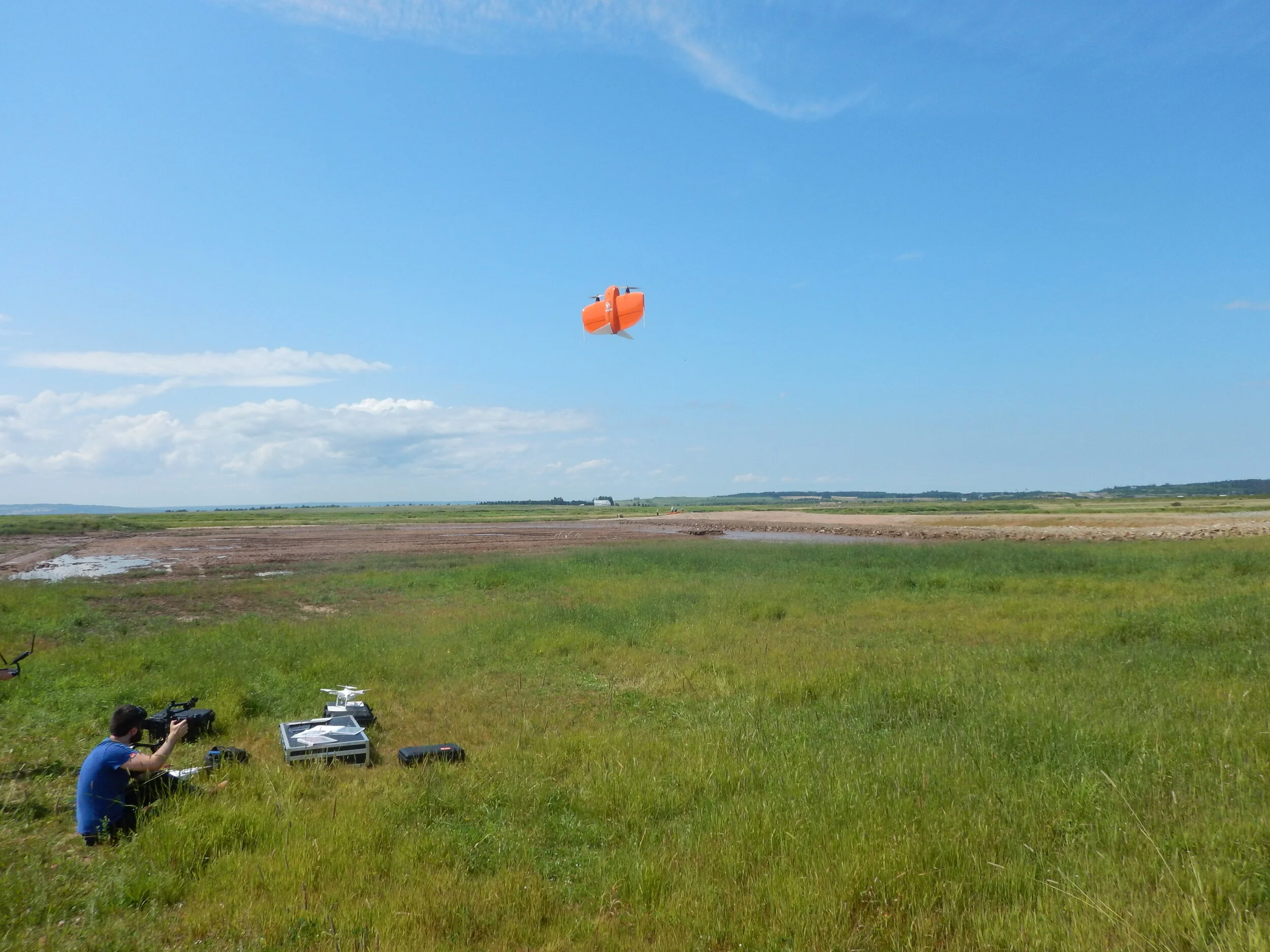
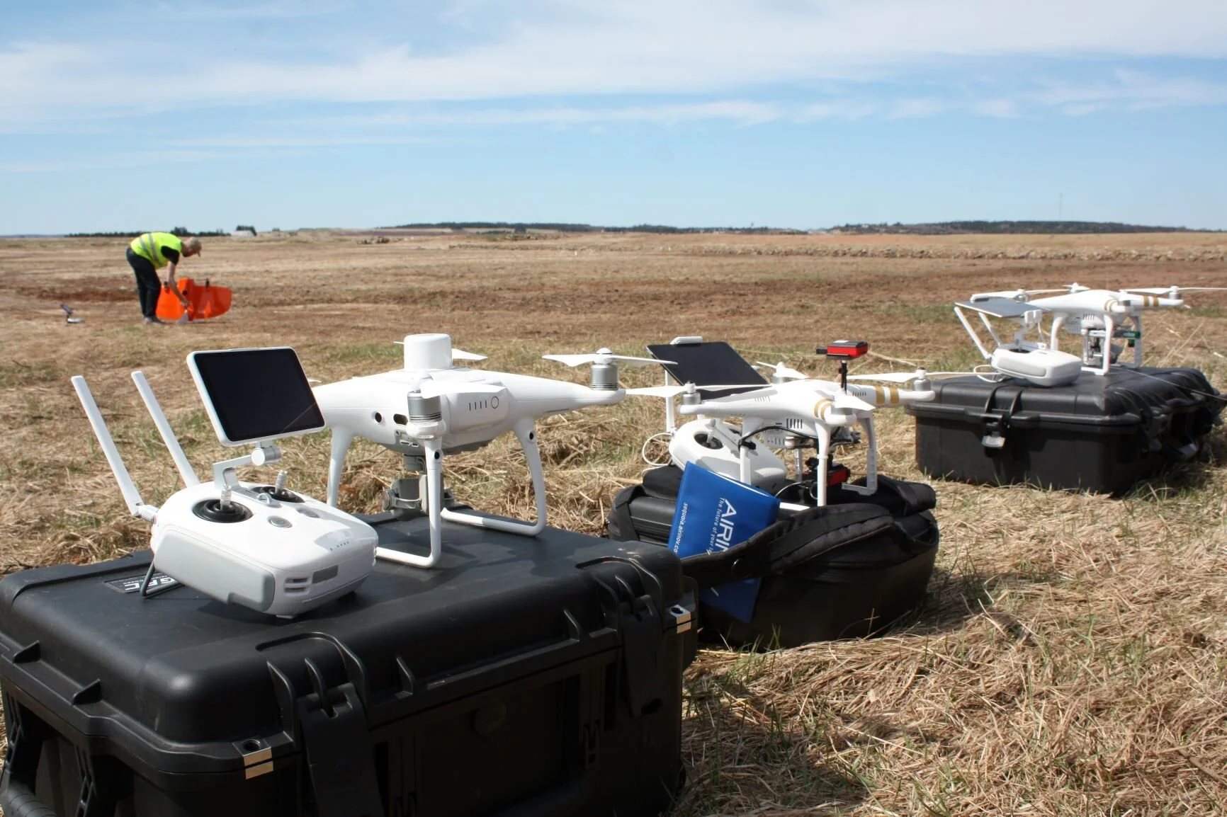
The purpose of the unit is to provide the necessary infrastructure and geomatics software to support research within the Maritime Provinces. Researchers (including graduate students) have access to GIS, AutoCAD, remote sensing, and graphical software as well as real-time kinematic GPS equipment, total station for surveying, large format plotter, and an EM38 conductivity meter. In addition, MP_SpARC provides oversight and support for research applications of Remotely Piloted Aircraft Systems (drones) including RPAS pilots with advanced certification. Our current fleet includes a range of systems suitable for a wide range of applications.
Contact us for further details: greg.baker@smu.ca
The Ecology of Plants in Communities (EPIC) lab
Study of plant communities and vegetation in Atlantic Canada.
We are interested in the structure and function of plant communities and how they can benefit human communities. Our study systems include urban habitats, barrens and heathlands, tidal wetlands and green roofs. Restoration ecology and ecological engineering are key applications of our work and our students are involved with restoring tidal marshes, barrens and constructing green roofs.
For more information visit: https://sites.google.com/site/lundholmlab/home


