
Background
Canadian coastal communities and shorelines, including many in Atlantic Canada, are vulnerable to flooding and erosion caused by the combined effects of high tides, storm surges, and waves. In many locations, the risks associated with coastal flooding and erosion are expected to increase over the coming decades due to urbanization, rising sea levels, and shifting weather patterns associated with climate change. Nature-based infrastructure has the potential to effectively manage flood and erosion risk and provide many positive environmental and societal co-benefits.

Figure 1. Clifton Marsh in Nova Scotia
The “Nature-Based Infrastructure for Coastal Resilience and Risk Reduction” project brings together engineers, scientists, and practitioners from federal, municipal and First Nations governments and academia to develop an improved understanding of the performance of nature-based infrastructure in Canadian coastal environments. This project will draw on lessons learned from studying four sites in diverse coastal settings across Canada, two in British Columbia and two in the upper Bay of Fundy, to develop new knowledge and design guidance for nature-based infrastructure. The two sites in the Bay of Fundy include a large, natural foreshore marsh near Clifton, Nova Scotia, and the Chignecto Isthmus, which straddles the border between Nova Scotia and New Brunswick.
Project Summary and Objectives
The research will couple field monitoring, numerical modeling and laboratory experiments to demonstrate how nature-based approaches can be applied in Canada in the broader framework of coastal hazard risk management to maximize societal and ecosystem benefits.
The primary objective of the project is to develop a Knowledge Base and Design Guide on implementing nature-based infrastructure in coastal communities. The design guide would serve as a technical reference for designers, enabling them to conduct robust feasibility assessments, planning, and design for coastal communities considering nature-based infrastructure.
Ongoing and Planned Research in the Bay of Fundy
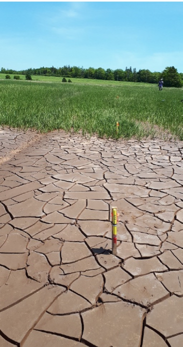
Figure 2. Field instrumentation at a natural foreshore marsh in Minas Basin.
Field, laboratory and numerical modelling activities focused on the Bay of Fundy sites are aimed primarily at understanding the role and effectiveness of intertidal marshes in nature-based solutions to flood and erosion risk management, within the context of this unique, mega-tidal environment. The research will include an investigation of the role of marsh vegetation in attenuating storm waves and alleviating flood and erosion hazards, and the potential impacts of managed dyke realignment on regional hydrodynamics.
A field campaign, led by researchers at Saint Mary’s University and Natural Resources Canada, commenced in the natural foreshore marsh near Clifton, Nova Scotia in June 2020. The field research activities involved conducting wave measurements along a shore-perpendicular 50 m transect from the mudflats across the Spartina alterniflora (smooth cordgrass) salt marsh (Figure 1). A preliminary analysis indicates a clear difference in the capacity of vegetation to attenuate waves depending on the tidal regime (i.e. spring or neap tides). For water depths less than 1 m, the wave height was reduced by more than 60% within the first 10 m of salt marsh vegetation, and for depths greater than 1 m, a similar reduction was achieved within 45 m of the vegetated canopy. This demonstrates the clear potential of Spartina alterniflora to dissipate wave energy and reduce impacts on dyke infrastructure. These findings are consistent with extensive studies conducted in Europe in similar environments. In 2021, the plan is to shift the focus of the field activities to the Chignecto Isthmus, drawing from lessons learned during the deployments in Minas Basin.

Figure 3. Scale physical model of hybrid dyke-marsh features in the National Research Council Canada’s coastal wave basin in Ottawa.
Laboratory research activities to date have included a series of 1:20 scale physical model experiments, conducted in a 63 m by 14 m wave basin at the National Research Council Canada’s Ocean, Coastal and River Engineering research centre (Figure 2). Model dyke and marsh platform features, loosely based on archetypes along the Chignecto Isthmus, were constructed in a wave basin at 1:20 scale and exposed to a range of waves and water level conditions. The experiments were conducted using idealized surrogate vegetation, and the model setup featured four parallel flumes which could be easily customized to investigate various scenarios simultaneously. The experiments investigated the sensitivity of wave attenuation and dike overtopping to the length of the vegetation field, vegetation characteristics (stem density, height, and flexibility), and varying water levels and wave conditions.
Numerical modelling research activities will leverage existing hydrodynamic models covering the Upper Bay of Fundy, developed previously by researchers at Queen’s University and the National Research Council Canada. A multi-scale modelling approach is envisaged, whereby a series of models with varying spatial and temporal resolution will be used to characterize interactions between intertidal salt marshes and the surrounding environment. This will include quantification of wave energy dissipation provided by newly developed Spartina alterniflora marsh at the Ducks Unlimited Aulac managed realignment site compared to adjacent cliffed natural marshes, narrow foreshore marshes in front of dykes, and traditional rock armouring. The models will be calibrated and validated using field measurements, before applying them to investigate the potential for salt marshes and different managed realignment of dykes scenarios to contribute to flood and erosion risk management along the Chignecto Isthmus, and implications for regional circulation and transport processes.
Project Partners and Funding
The project is supported by the Canadian Safety and Security Program, led by Defense Research and Development Canada’s Centre for Security Science, in partnership with Public Safety Canada. Project Partners are the National Research Council Canada, Indigenous Services Canada, Natural Resources Canada-Geological Survey of Canada, Crown-Indigenous Relations & Northern Affairs Canada, City of Surrey, Metlakatla First Nation, Semiahmoo First Nation, First Nations Emergency Planning Secretariat, Saint Mary’s University, University of Ottawa, and Queen’s University.
Contact
Contact Danika van Proosdij at dvanproo@smu.ca for more details.


